This is a trip with a lot of driving in it for a weekend, around 787km, but most of the roads are well maintained and, if you take off on Friday afternoon and stay at Southern Cross overnight, as Nick and I did, or even Yellowdine it becomes easily achievable over the remaining two-day break. The route takes in the early gold mining centre of Southern Cross at the edge of the wheat belt, Yellowdine Rock further East and its former railway dams, a lonely granite dome out in the bush called Condarnin, and the fascinating abandoned settlement at Mount Palmer. You’ll return via Marvel Loch, Frog Rock, and Jilbadgie Rocks. We chose to camp at the latter spot on the Saturday night but there are many other options. Most of the wheatbelt can be recrossed following the old Goldfields Road, the same track used by the wheelbarrow pushers of Western Australia’s fabulous goldrush years. The Goldfields Road also approximates the route pioneered by that indefatigable explorer of the 1860s, Charles Cooke Hunt. The trip notes will guide you to several of his watering places and other wells used by settlers, travellers and teamsters on the original road to our eastern goldfields. Coming home by this route on a drowsy December Sunday some years ago, Nick and I passed only four vehicles between Jilbadgie Rocks and York. If you run out of time on the return journey, it’s easy to regain the highway from practically any of the crossroads you encounter. After Youndegin and York on the Goldfields Road, it’s an easy drive through the hills to Perth. No fuel is available on the trip noted route between Yellowdine and York, but short detours will get you to roadhouses in Merredin, Kellerberrin or Tammin should you need to refuel along the way.
Please note that you can purchase this and 17 more great day trips out of Perth in 4WD Weekends out of Perth
The first major gold finds in Western Australia were in the Kimberley during the mid-1880s. Prospecting to the eastward of the settled districts on the Avon River finally paid off when the magic metal was located in the Highclere Hills by Anstey, Payne and Greaves. Later finds in the region included Golden Valley and Southern Cross. Tom Riseley and Mick Toomey, who named their find after the constellation that led them to it, found gold at the latter place on 14 January 1888. The Yilgarn Goldfield was proclaimed in October that same year, ‘Yilgarn’ being the local Aboriginal word for the white quartz that was scattered all around the region. The township that sprang up on the find was proclaimed as Southern Cross in 1890, the first Yilgarn Roads Board was elected in March 1892, and the region was declared a municipality some six months later. Such was the frenzy of prospecting from that time that the fame of Southern Cross was soon eclipsed by the phenomenal finds at Coolgardie and Kalgoorlie and the gold rushes that followed. Nevertheless, Southern Cross is steeped in gold mining history and a visit to the original Mining Registrar’s Office and courthouse, now the Yilgarn Historical Museum, is well worthwhile. The beautifully restored Palace Hotel and tombstones from the old cemetery set up at the tourist information park on the way out of town are also worth a look.
After Southern Cross, the farms dwindle as you get out beyond the wheat belt. Rainfall is too unreliable to grow the golden grain out here. Instead, you have the opportunity to gain some insight into the kind of endless thickets of scrub that our early explorers and prospectors had to fight their way through.
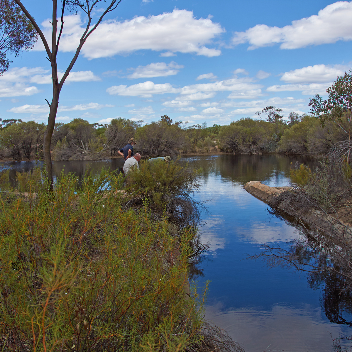
From Yellowdine Roadhouse, 33km East of Southern Cross, the trip notes will lead you across the highway to Yellowdine Rock, its twin railway dams and the superb stonework forming the catchment and several aqueducts channelling water into the dams. This engineering masterpiece was constructed around 1895 to supply water for locomotives on the Eastern Railway. There are some pleasant campsites in this vicinity and a track that partly circumnavigates the rock.
Back on the South side of the highway, you’ll find the Nevoria Yellowdine Road immediately East of Yellowdine Roadhouse. This road hasn’t seen a grader for many years and there are some deep potholes here and there. The signs stating ‘DANGER: NOT ALL WEATHER ROAD’ and ‘ROAD CLOSED: ENTER AT OWN RISK’ give a clear indication that this road should only be tackled when its dry. The same goes for all side tracks in this region. Don’t expect assistance from the roadhouse or locals if you’re foolish enough to ignore the signs when it’s wet.
Condarnin Rock was visited during the explorations of C.C. Hunt in August 1865. We sighted snakes and dingos here during our visit. There are a few shallow rockholes in a creek bed between the rock and the salt lake to the East and a Currajong tree near the NW corner of the lake with ‘AD 1900’ marked faintly on its bark. The significance of this mark is unknown. Remember that you are in a nature reserve and open fires are banned. It’s a pleasant area for bushwalking. Vehicles, especially trailbikes, must be confined to the end of the access track at the SE edge of the granite. Further East is Heaneys Find at the edge of the salt lake, another interesting spot for a wander. The corduroyed lake crossing is rotten and treacherous and definitely not recommended unless the crossing is bone-dry and rock-hard.
Further South, Mount Palmer was one of those gold finds that helped pull Western Australia out of the Great Depression. Prospector A. C. ‘Daddy’ Palmer was the first to raise encouraging samples from a wooded ridge on the western perimeter of the salt lake in the spring of 1934. Other prospectors soon pegged the surrounding ground and the mining entrepreneur, Claude de Bernales, was quick to assess the possibilities and react. His company, Commonwealth Mining and Finance, set out to purchase the best of the leases by offering the syndicates £10,000, plus £2,000 in shares to each partner. Each party was also permitted to continue removing ore for a month after the deal was signed. Jack Whinfield, a Goldfields Water Supply inspector who had been on the scene early and pegged some good ground, put on 22 workmen and mined 1,250 tonnes of ore in the month. This assayed at over 60 grams per tonne and yielded 67.6 kilograms of gold, then worth £21,000. This amounted to no small fortune in those days and Whinfield was quick to resign his Water Supply job. de Bernales publicised the discovery of ‘a real Aladdin’s Cave’, and London investors poured cash into the float. One London newspaper claimed the find as one of the richest gold mines in the world and hailed the entrepreneur as a genius.
By December 1934, there were 200 men on site and leases were pegged for kilometres north and south of the main strike. There was talk of ‘Yilgarn’s Golden Mile’ and the scene was reminiscent of the gold rushes of the 1890s. For a time, the field supported both alluvial diggers and shaft mining, with rich surface deposits being found on the lake shore. While the operating company, Yellowdine Gold Development, commenced sinking shafts to open up the lode, a variety of improvised shakers, dry-blowers, puddlers and cradles were operated by strings of alluvial diggers who attacked the lake edges with everything from buckets to horse scoops until the shallow deposit was exhausted. The deeper operations proved rewarding for de Bernales who erected a 20 head battery. In its first 20 months of operations to the end of 1937, 85,000 tonnes of ore were crushed for gold worth £470,000. Working costs were only £100,000 based on a workforce of 130 men, and a dividend of more than £200,000 was paid out to shareholders. In the end though, the lode did not go deep and mining operations were eventually shut down in 1944. Nevertheless, during the decade it operated, Palmers Find Mine produced 4,928 kilograms of gold from 310,728 tonnes of ore, a thoroughly worthwhile venture if not the bonanza of the de Bernales beat-up. Sadly, the finder of the field made nothing. ‘Daddy’ Palmer’s lease was not one of those taken up by de Bernales and it soon played out. Gold is a fickle mistress.
Typically for those times, de Bernales’ company provided neither amenities nor accommodation for its workforce who initially camped around the minesite, sleeping in humpies or under stolen railway tarpaulins. Complaints about the lack of sanitary arrangements and the risk of typhoid led the government to survey 200 lots nearby, gazetted as Mount Palmer townsite on 2 August 1935. A pan sanitary system was initiated and an extension from the goldfields pipeline supplied water to the town which was fully functional by the end of the year with a population exceeding 500. A description in the Yilgarn Shire history states:
The place comprised corrugated iron shops and hessian and iron houses mainly erected by the miners themselves using bush timber and with earthen floors often linoleum covered. Rows of neatly white-washed houses were characteristic of mining towns of the period. Most services were available: Dick Monks’ power station; Ben and Dulcie Cox’s general store and post office; A. Leggett’s billiard saloon; John Bryant’s newsagency; a garage; Clement and Margaret Keitel’s restaurant and hall in which Bob Davey screened films regularly; Norm Temby’s and Errol Haynes’ butchers’ shops; Joe McDonald’s bakery; Les Andrews’ greengrocery; and the boarding houses of Gwen Green, Kathleen Hayden and Ester Carnicelli, for there was a preponderance of unattached men in the town who relied on such facilities. Cricket and football were played on an oval laid out on a nearby clay pan. The football team won the Yilgarn district’s 1935 premiership – undefeated for the year. The reason seemed obvious: the mine foreman, Charles Perkins, supported the team and he recruited only the best footballers from the men who congregated outside his office each morning seeking work.
It was a lively town on pay nights with drunkenness and street fights not uncommon and difficult to control as Constable Joe Farrell visited from Marvel Loch only fortnightly. The town settled down after Alice M. Cummins, who was associated with the Kalgoorlie and Merredin breweries, opened a substantial brick hotel [on the corner of Palmer and Mackey streets] on 18 December 1936.It then became easier to control sly grog sales; and after 16 men were fined £2-0-0 each in November 1937 for playing two-up in a common gaming house, the police were able to isolate the ring in the bush well away from the townsite.
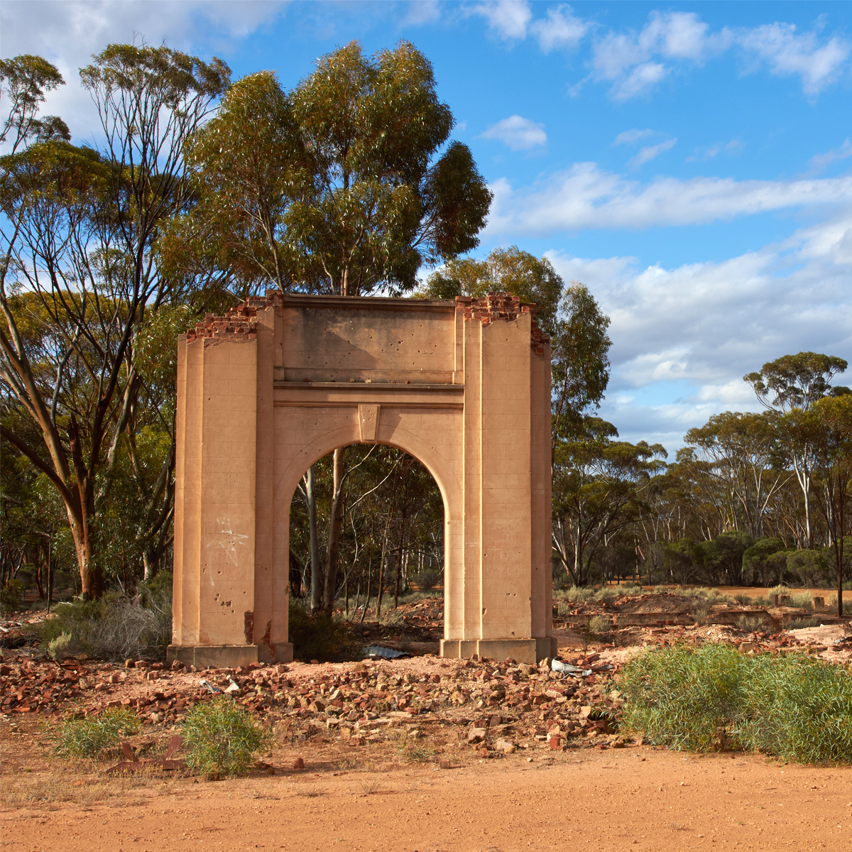
Mt Palmer’s rapid growth was typical of the rise of mining towns. It faded just as quickly when the mine closed in 1944. The area could not support prospectors. Nor were there farmers close by to use its facilities. The town simply ceased to exist.
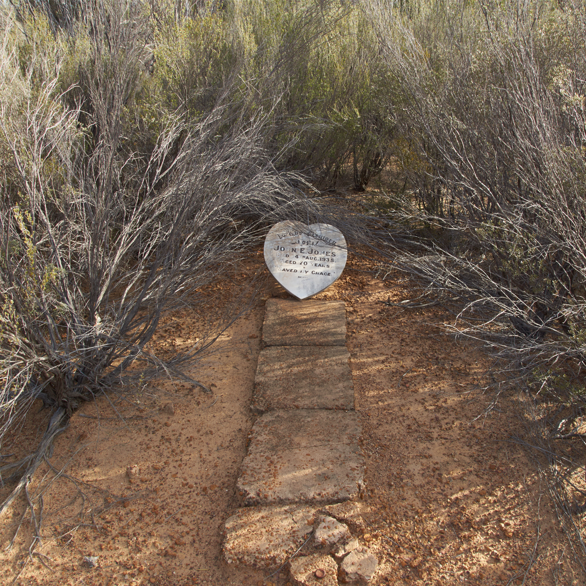
The hotel, currently ‘closed for renovations’, is the most visible ruin remaining, but evidence of small shops and family residences can be found scattered all through the now silent bush. A short distance to the West, one can visit the cemetery where there are several graves, one with a tombstone in memory of John Ebenezer Jones who died in 1938 aged 70 years. Jones, a gold miner from Mount Egerton in Victoria, had spent time at Kanowna in its heyday, before going back to his home State. He later returned to the West, residing with his daughter, Annie, and son-in-law, Maitland White, who ran a store at Mount Palmer.
Marvel Loch, originally gazetted in 1911, was a mining town that was rejuvenated during the mining revival of the 1930s. Unlike several neighbouring towns, Marvel Loch survived the closure of its principal mine and lived on as a supply centre for surrounding farmers and ever-hopeful prospectors. The town is currently enjoying yet another gold mining revival with several important mines being redeveloped in its immediate vicinity.
West of Marvel Loch stretches the Western Australian wheatbelt and the farms passed along Frog Rock Road are large and impressive. This was not always the case; however, and farming in the region had painful beginnings. Most of the land was cleared in the 1920s when the number of farmers in the district rose from 11 to 800. This growth was largely brought about by the optimism of James Mitchell, Premier of WA from 1919 to 1924 and successive Labor Ministers for Agriculture, Troy and Millington, from 1924 to 1930. Under the Miners’ Phthisis Act, Miners’ Settlement blocks were offered to goldfields’ men who had been exposed to deadly mining dust for extended periods. It was recognised that these men were unfit for hard manual labour, so those with sons who could work on the land were chosen for the Yilgarn land grants. There was no experimentation or testing of the lands prior to settlement. Other than surveying and allocating blocks to the flood of applicants, the government initiated no development strategies; no realistic appraisal of long term market prospects for wheat. Rains were expected to follow the plough, crops were expected to flourish and harvests were expected to be plentiful. After struggling for years to establish their farms, most of these battlers were subsequently caught out by the Great Depression. Many were ruined in 1931 when, despite a bumper crop, wheat prices collapsed. These were trying times indeed for those on the land and there are many sad stories of extreme hardship to be told of those days. Conversely, gold prices soared during the ‘30s, and those who were able returned to the diggings. The mines at Marvel Loch and Mount Palmer were instrumental in saving the farming district from complete abandonment and the amalgamation of properties after the depression eventually resulted in the successful agricultural development of the district.
Granite outcrops worth exploring en route include Jilbadgie Rock and Frog Rock. From Waypoint 2O, Hunts Well near Burracoppin, the trip noted route follows the old Goldfields Road back to York. Apart from old wells tripnoted along the way, our most recent revision included a visit to “Shark Mouth”, an awesome Aboriginal site located just north of the road where visitation has been facilitated by a pedestrian gate in the farmer’s fence. Should you stop in to view this site, please treat it with respect.
Regardless of the type of adventure you are embarking on, keeping the basics in your vehicle means that you should be bale to deal with most situation that may arise.
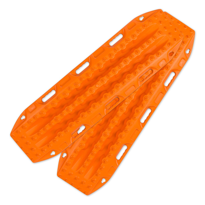
Great for getting yourself out of a sandy situation. They also work really well in mud.
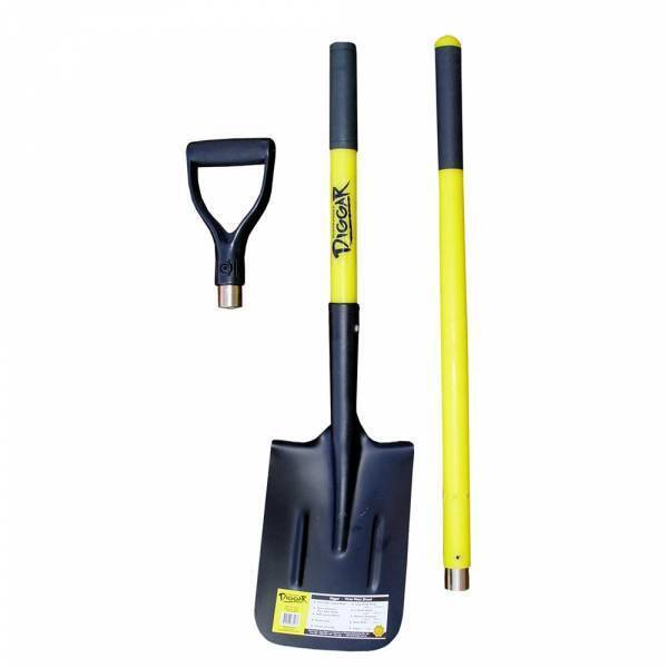
You never know when you are going to have to dig yourself out of trouble or when there is a call of nature that requires a hole.
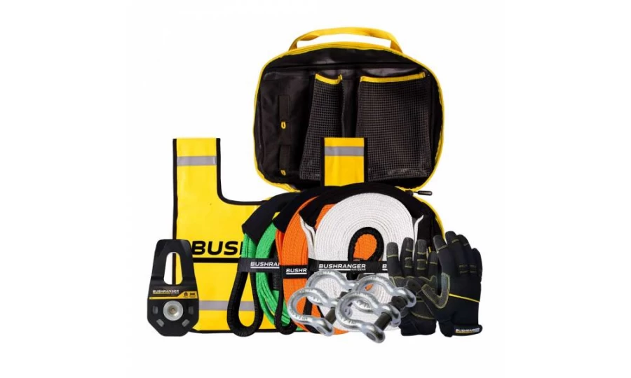
You don’t always need this equipment BUT when you do, you do. Best to ensure that it is always in your vehicle.

Much better than a stick and a lot more accurate. You will more than likely need to adjust tyre pressure on this trip.

If you need to let your tyres down for any reason then you will also need to pump them back up again.
Being so close to Perth is no reason to disregard the basic planning process. Make sure you let someone know where you are going and when you intend to be home. Mobile phone coverage should not be relied upon. This could impact how well Google Maps (or equivalent works) and you should either invest in a good quality GPS unit or ensure you have a map of the area.
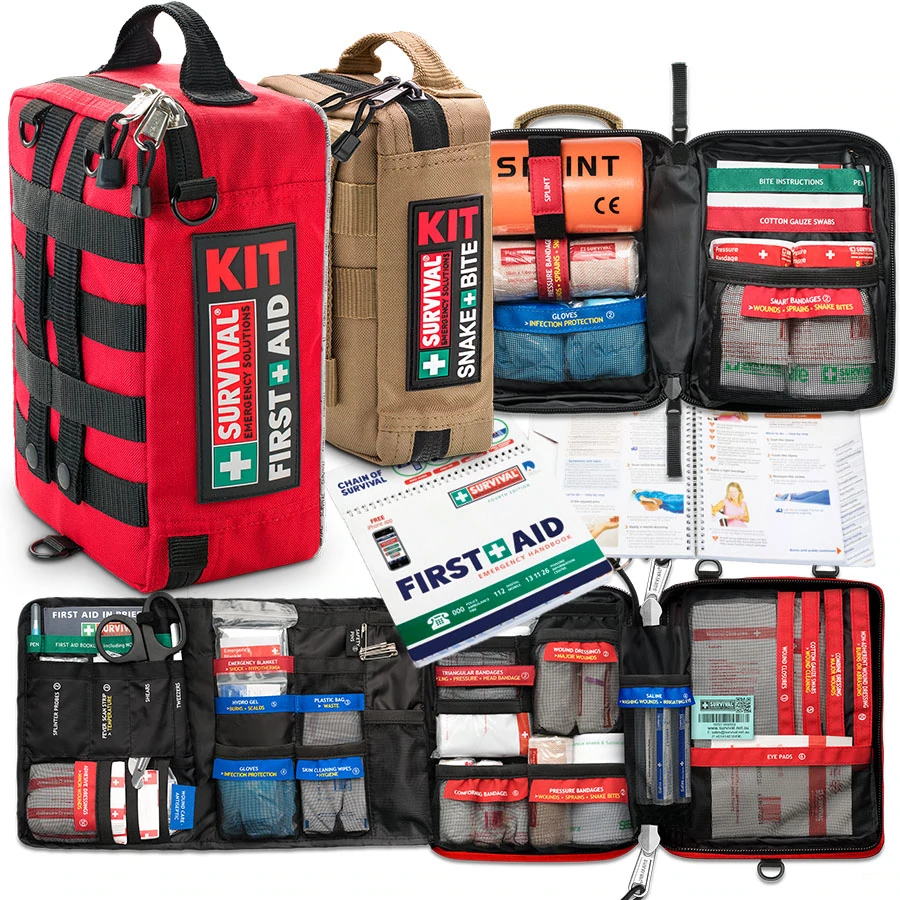
Something to deal with minor cuts and scrapes as well as compression bandages to treat snake bite.
Make sure you have some sunscreen and insect repellant with you.

Ensure there is enough water in the vehicle for everyone who is coming with you.

We use and recommend HEMA’s HX2 GPS navigator. The unit does not require mobile phone signal to operate, shows you exactly where you are and what is around you (including points of interest and facilities). The HX2 also gives you turn by turn navigation when back on the bitumen if you need it.
Your other option is to grab a copy of one of HEMA’s maps or 4WD atlas relevant to your area of travel.
If you have a smart phone or an iPad (preferably one that can take a mobile SIM card – you don’t need a SIM installed) you can look at HEMA’s CamperX or 4×4 Explorer.
Keep a roll in the car, along with hand sanitiser and maybe some wipes. Make sure you have a rubbish bag handy and bring all of your rubbish home.
Don’t spend the entire trip driving, make sure you stop and explore. It’s a great opportunity to build some memories with the family.
Time your trip so you stop at Mt Observation and have either morning tea or a picnic lunch there. Spend some time exploring the area and take in some of the views.

When you stop and sit for a little while you will be amazed at the amount of wildlife that you will spot.
Take a camera and try your hand at some scenic shots or even some macro. It’s also a great spot to get some nice portrait shots of friends and family or even a candid shot of them enjoying nature.
There are a couple of ways that you can get your hands on the instructions for this little adventure.
Grab a copy of 4WD Weekends out of Perth from our web shop or your nearest 4WD accessory store.
You can also purchase our basic Fact Sheet and Map from our web shop for $2.95
Copyright © Western 4W Driver. All rights reserved.
Site by Concept Marketing. Privacy Policy.

