Roly Dimer was a government dogger who worked the region north east of Koolyanobbing from 1957 and was responsible for establishing most of the tracks to rock holes in the area. At 386km total distance, with slow going on many of the minor tracks, this trip will require an overnight camp if you want to explore the various rocks along the way. The chance to spend some time in the stunning Helena and Aurora Range should also be a major draw-card for anyone contemplating this trip.
Please note that you can purchase this and 15 more great day trips in the Goldfields by grabbing a copy of 4WD Days in the Goldfields
This trip begins at the Palace Hotel, in Southern Cross. Despite being described as having “scraggy bush, a canvas store, a hessian pub and no water” during its earliest days, Southern Cross was gazetted as a townsite under the Land Management Act on 20 March 1890. The settlement quickly boomed as a business centre and soon boasted several hotels. One of the earliest, “Hampson’s Pub” on the Orion/Antares intersection, was blown away in a storm and replaced by the Exchange Hotel (known locally as the “Blood House’). The present imposing, two-storey, Federation Filigreee style building was built by Frank Snook, the Mayor of Southern Cross, in 1911.
The run out to Koolyanobbing is bitumen, but kangaroos, emus and the odd feral donkey can sometimes be a hazard along this stretch. Named the “Barlee Range” after Colonial Secretary Frederick Palgrave Barlee by explorer C.E Dempster on 26 July 1861, this toponym was rejected by the authorities owing to duplication. C.C Hunt, the next explorer to visit this rugged region three years later, recorded the Aboriginal name as Koolyanobbing and this was added to official maps immediately. The name is thought to mean “place of large rocks”. When Henry Dowd prospected in the vicinity in 1887, he thought the rocks were valueless. John Chadwick thought otherwise when he passed through the locality in 1894. He returned to the area ten years later in company with Fred Gray for a more detailed examination. This time his efforts were rewarded and a five-stamp battery was operating there before the end of 1904.
In 1938, the Geological Survey Branch of the WA Mines Department surveyed the iron ore deposits at Koolyanobbing. Total reserves were estimated at some 60 million tons, mostly 61% pure iron ore. However, it wasn’t until the early 1960s that BHP and Western Mining Corporation began mining these deposits. A government townsite was declared there in 1965 and the railway, being upgraded to standard gauge at the time, was re-routed to pass close to the iron ore mines. Railing of the forest ore from Koolyanobbing to Australian Iron and Steel Pty Ltd’s steel plant at Kwinana occurred in 1967.
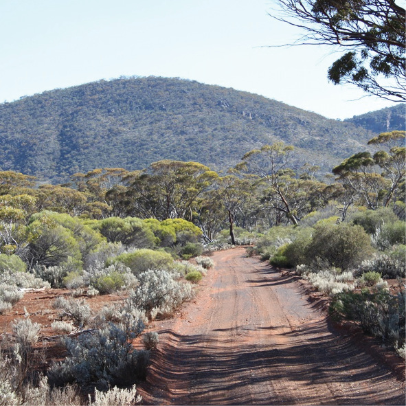
A pleasant bush drive follows the mining activity at Koolyanobbing until your first views of the picturesque Helena and Aurora Range.
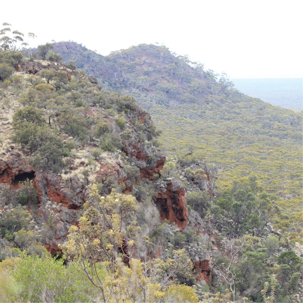
There is a story attached to the naming of this range of rocky hills. C.E Dempster named the westernmost hill “Mount Kennedy” in 1861, yet another of the names he bestowed that wasn’t adopted for mapping because of duplications. Surveyor E.H Abalone recorded the traditional Aboriginal name of this hill as Bungalbin in 1895, but the main range remained without an identifier until 1976. In that year, examination of an old plan by Lands Department staff revealed the plotted route of a little-known exploratory trip by Alexander Forrest out north of Hunt’s perambulations. This trip had been undertaken in August 1876 and the surveyor recorded an extensive high range he had named Helena and Aurora Range. Almost a century after Forrest’s visit, the Geographic Names Committee approved the name for use on maps.
Rising more than 200m above the surrounding plain, the track up onto the rugged spine of the range provides fantastic panoramic views of the country for miles around. Care should be taken on the steep descents but tracks through the surrounding bush do not present problems other than thick billowing bull dust in the dry and heavy gluey red mud when wet.
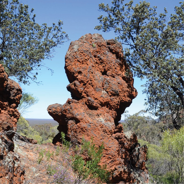
About 20km of excellent sand plain track separates the eastern extremity of the Helena and Aurora Range from Pittosporum Rock which is located on the western approach to the Hunt Range. The rock is named after Pittosporum phylliraeoides, a tree of the arid regions otherwise known s as “native willow”, “bitter orange” or “cheese wood”. An impressive specimen is growing directly opposite the rockhole at this granite outcrop.
The orange fruit, while not poisonous, is extremely bitter and will dry out your mouth for hours.
Pittosporum Rock affords views of the Helena and Aurora Range and the rockhole is visited by many bird species. Dingoes also frequent the area and have been seen drinking from the rockhole.
Through the low, stony hills of the Hunt Range, named after the explorer C.C Hunt, bush fires have left their mark on the vegetation, bring down trees across tracks, which can make travelling through difficult. There is no danger of taking the wrong track when working your way around these obstacles as there is only one route through to Kurrajong Rocks.
These series of granite outcrops are also named after an arid region tree. Brachychiton gregorii. In the early days of the colony, this species was knowns as the “government tree” because the shape of their leaves resembled the broad arrow that denoted government ownership.
Unfortunately, fire has destroyed most of the larger specimens around Kurrajong Rocks.
The main rockhole is adorned with the names of several members of the Dimer family. Roly Dimer worked this region as a government dogger from 1957 and was responsible for putting through most of the tracks you have been following.
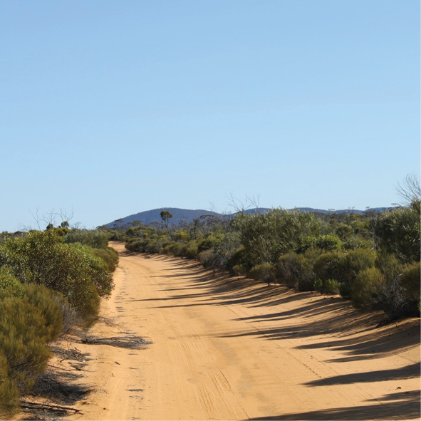
South of Kurrajong Rock, you are travelling through country more typical of our dramatic red soil regions. 67km south t Ives Rock and Wallangie Soak is a great bush drive with the occasional crab hole plain and washaway just to keep it interesting. The track passes to the west of the rock and soak in scrub thick enough to hide them from view, so pay attention to the trip notes.
The aboriginal name of the soak, sometimes referred to as “Dead Man’s” by doggers, sandalwood pullers and other locals, is Wallangie. This was shown on Mines Department lithographs as early as 1894 and was used as the starting point for gazzetal of water reserves in January 1896. A shallow, stone-lined well, was put down on the soak as part of a road between Siberia and Yellowdine established by the Public Works Department.
Frank Hann, following the newly opened route, camped here on 16 July 1901 recording it as a “splendid well and camp”. The rock itself is worth a walk around and has an interesting gamma hole on its lower slopes just south of the well.
A grave a few hundred metres west of the rock bears the following inscription:
“This unknown man died at this waterhole and was buried here by Albert Ives and son Len in year 1910”.
This seems to provide the origin of the rock’s name and the reason for it being known to many as “Dean Man’s”.
After Ives Rock, the track improves a little, as you are travelling through the former pastoral lease of Jaurdi. This station has been taken over by the Department of Parks and Wildlife (DPAW) which de-stocked it an retained improved the homestead to be used as a field study centre.
There are some superb tracts of typical goldfields forest country interspersed by picturesque plains now accessible to bird watchers and botanists.
Past Jaurdi Homestead, after re-crossing the standard gauge railway, sections of the track have succumbed to flooding and washaways are frequently encountered. Just before reaching the Great Eastern Highway, a visit to the Boorabbin railway dams is recommended.
Moorabbin Rock is another of the granite outcrops that provided vital water sources facilitating the early exploration of this inhospitable region. The Aboriginal names was recorded by C.C Hunt on 20 May 1865, and this rock becomes part of the explorer’s line of wells, soaks and dams later followed by thousands of men who rushed the goldfields found way out east of Southern Cross in 1893.
When the railway line was extended to Coolgardie in 1895-96, Chief Engineer C.Y O’Connor ensured that it followed this line of granites. Reliable supplies of clean, fresh water were vital to the operation of steam locomotives and O’Connor followed the same strategy as he had on the Yilgarn line.
Typically, stone walls were constructed around the granite outcrops and the run-off directed to holding tanks excavated nearby. In 1984, the Public Works Department constructed a clay-lined earth tank at the foot of Moorabbin Rock for the use of those travelling by road between Southern Cross and Coolgardie. For railway purposes, this was later doubled in size by the construction of a second earth tank taking the flow of the old original one, with a steam pump to convey the water to an overhead tank alongside the line.
The stonework in the walls and aqueducts supplying these holding facilities is exceptional and the entire system is still working despite the collapses caused by occasional flooding.
North of the two dams is an extensive quarry that was worked for many years t supply blue-metal for the ballast and roadworks
Boorabbin. an important watering stop for railway traffic, was declared a townsite in July 1898 but was later abandoned when the standard gauge line was re-routed through Koolyanobbing in the 1960’s.
Nowadays, there are only sparse traces of railway infrastructure and few introduced trees such as Moreton Bay Figs to remind us of its heyday.
The 96km return to Southern Cross via Great Eastern Highway is broken by the tiny settlement of Yellowdine, now limited to a fuel stop and motel.
Regardless of the type of adventure you are embarking on, keeping the basics in your vehicle means that you should be bale to deal with most situation that may arise.
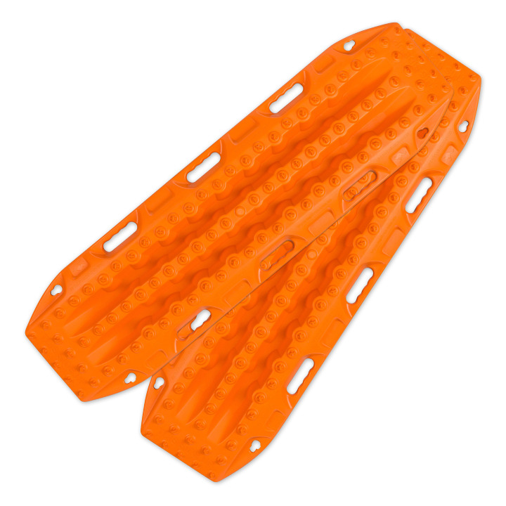
Great for getting yourself out of a sandy situation. They also work really well in mud.

You never know when you are going to have to dig yourself out of trouble or when there is a call of nature that requires a hole.
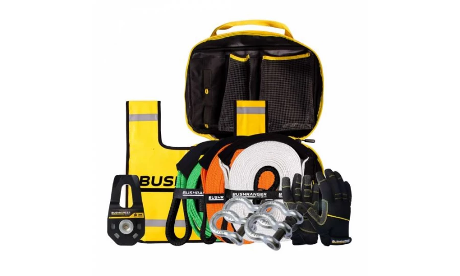
You don’t always need this equipment BUT when you do, you do. Best to ensure that it is always in your vehicle.

Much better than a stick and a lot more accurate. You will more than likely need to adjust tyre pressure on this trip.

If you need to let your tyres down for any reason then you will also need to pump them back up again.
Being so close to Perth is no reason to disregard the basic planning process. Make sure you let someone know where you are going and when you intend to be home. Mobile phone coverage should not be relied upon. This could impact how well Google Maps (or equivalent works) and you should either invest in a good quality GPS unit or ensure you have a map of the area.

Something to deal with minor cuts and scrapes as well as compression bandages to treat snake bite.
Make sure you have some sunscreen and insect repellant with you.

Ensure there is enough water in the vehicle for everyone who is coming with you.
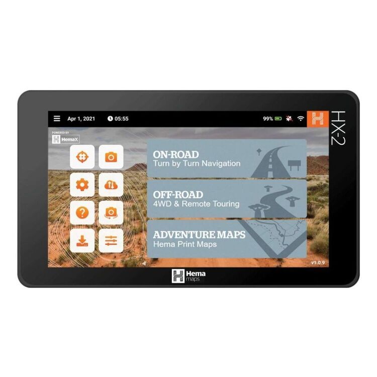
We use and recommend HEMA’s HX2 GPS navigator. The unit does not require mobile phone signal to operate, shows you exactly where you are and what is around you (including points of interest and facilities). The HX2 also gives you turn by turn navigation when back on the bitumen if you need it.
Your other option is to grab a copy of one of HEMA’s maps or 4WD atlas relevant to your area of travel.
If you have a smart phone or an iPad (preferably one that can take a mobile SIM card – you don’t need a SIM installed) you can look at HEMA’s CamperX or 4×4 Explorer.
Keep a roll in the car, along with hand sanitiser and maybe some wipes. Make sure you have a rubbish bag handy and bring all of your rubbish home.
Don’t spend the entire trip driving, make sure you stop and explore. It’s a great opportunity to build some memories with the family.
Time your trip so you stop at Mt Observation and have either morning tea or a picnic lunch there. Spend some time exploring the area and take in some of the views.

When you stop and sit for a little while you will be amazed at the amount of wildlife that you will spot.
Take a camera and try your hand at some scenic shots or even some macro. It’s also a great spot to get some nice portrait shots of friends and family or even a candid shot of them enjoying nature.
There are a couple of ways that you can get your hands on the instructions for this little adventure.
Grab a copy of 4WD Days in the Goldfields from our web shop or your nearest 4WD accessory store.
You can also purchase our basic Fact Sheet and Map from our web shop for $2.95
Copyright © Western 4W Driver. All rights reserved.
Site by Concept Marketing. Privacy Policy.

